Projects
Exxon Mobil (Esso Highlands Ltd) - PNG LNG project
(August 2012 -)
- Validation of LNG well locations
- prepare PNG DPE compliant well location diagrams
Papua New Guinea Government - Department of Lands, Office of the Surveyor General
(July 2011 -)
- Geodetic support and training for geodetic section
- Densification of the PNG94 geodetic datum
Wafi-Golpu Joint Venture, Papua New Guinea
(April 2011 -)
- Computation of transformation parameters from AGD66 to PNG94
- Engineering survey control
- Geodetic and GIS support for JV
Talisman Energy, Western Province, Papua New Guinea
(December 2010 -)
- Survey validation
- Computation of transformation parameters
- Produce Minimum Survey Standards document
Marengo Mining, Yandera, Papua New Guinea
(October 2010 -)
- Diamond Drill Hole Location validation
- Establishment of regional geodetic network
- Computation of transformation parameters from AGD66 to PNG94
- Engineering survey control
- Tidal observations to estimate local MSL
- LiDar validation
- Geodetic support for GIS
Woodlark Mining, Milne Bay Province, Papua New Guinea
(August 2010 -)
- Establishment of PNG94 on Woodlark Island
- Computation of transformation parameters from AGD66 to PNG94
- Training of exploration surveyors in GNSS and Total station surveys
- Validation of Woodlark Mining geodetic network
- Tidal observations to estimate local MSL
InterOil, Papua New Guinea
(June-July 2010)
- Establishment of PNG94 in Gulf Province operations
- Computation of transformation parameters from AGD66 to PNG94
- Validation of Bathymetric Surveys on Purari River
- Validation of InterOil geodetic network
- Tidal observations at Kerema to estimate local MSL
Horizon Oil, Western Province, Papua New Guinea
(May 2010 - )
- Geodetic Survey to support regional exploration
- Validation of Cellar locations
Eaglewood Energy, Western Province, Papua New Guinea
(May 2010)
- Geodetic Survey to support regional exploration
- Validation of Cellar locations
MMJV - Hidden Valley Mine & Wafi, Papua New Guinea
(JV with Fugro Spatial Solutions) (March-April 2010)
- Ground control and validation of LiDar and Aerial Photography
- Computation of transformation parameters from AGD66 to PNG94
- Validation of Regional Geodetic Control for MMJV
Lihir Gold Ltd. - Lihir Mine, Papua New Guinea
Geodetic analysis (January 2010 - )
- Establish the PNG94 geodetic datum in Lihir and Namatanai
- Computation of transformation parameters from AGD66 and Lihir Grid to PNG94
- Geodetic Support for LiDar survey
- analysis of GNSS monitoring network
XStrata Copper - Frieda River, Papua New Guinea
Geodetic Survey, support and analysis (March 2009-)
- Establish the PNG94 geodetic datum in the Frieda River, Middle Sepik and Aitape
- Preliminary Tidal Estimation of MSL
- Geodetic Control for River Monitoring Stations
- Computation of transformation parameters from AGD66 and local grids to PNG94
- Validation of drill-hole collar locations
Oil Search - Papua New Guinea
Quickclose has provided critical geodetic support to Oil Search's PNG operations since August 2007:
- Validation and densification of the PNG Oilfields geodetic network
- Development of transformation parameters between AGD66, PNG94 and ITRF2000
- Establishment and survey of GPS Base stations
- Independent validation of well locations and other critical infrastructure
- Monitoring of tectonic deformation across the Papuan Fold and Thrust Belt (PFTB)
EOS - Papua New Guinea LNG Project
Development and extension of the LNG Project Geodetic Datum since July 2005
- Geodetic Data Analysis
- Geoidal Model evaluation
- Quality Assessment
- Advisory role on geodesy and datums
Papua New Guinea
from 2000 onwards
- Advise PNG Department of Lands on semi-dynamic modelling for the PNG Geodetic Datum
(PNG94)
- GPS and PNG94 Workshop for Association of Surveyors PNG (ASPNG)
- GPS and geodetic support for Asia Pacific Surveys
- GPS and geodetic support for Arman Larmer Surveys Limited
- Hidden Valley Mine (from April 2000)
- GPS/GNSS support for Arman Larmer Surveys
- GPS/GNSS support for Asia Pacific Surveys
- Geodetic support for Fugro Spatial Solutions
- Gedoetic support for AAM
FUGRO Spatial Solutions
LiDAR and Air Photo Control Support since February 2007
- Catchment Management Authority Surveys
- West Gippsland
- Corangamite
- Goulburn
- Murray Irrigation
- Menindee Lakes
- Darling River
- Lake Wivenhoe
- ALINTA Eastern Gas Pipeline
- NSW RTA Mt. Victoria Highway Upgrade
- Bowen Basin CoalConnect Rail
- Victorian Riparian Project 2009-2010
- Tasmanian Mining Areas (Rosebery-Zeehan) 2011
- Fugro PMS - Calibration Surveys
Peter Mulcahy & Associates
From February 2007
- Rural Cadastral Control Surveys
- Kangaroo Ground
- St. Andrews
University of Melbourne - Earth Sciences
April 2007 - August 2008
- Determination of MSL elevations of geological sites in the Murray Basin using
GPS
HP Calculator Programming
From 1998
- Maroochy Shire Council -2003
- Daishsat - 2003
- Les Tooby - 2005
- Faminco - 1998
- Department of Defence - School of Artillery - 1998
- AAM Group Whyalla - 2011
|
What we do
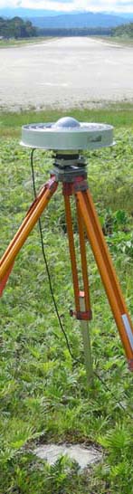
- Highest-precision GNSS (GPS)
- Datum establishment
- Geodetic Control Surveys
- Rural Cadastral Control
- Airborne Laser Scanning
(LiDAR) Ground Control
- Air Photo Ground Control
- Plane Grid Establishment
- Bringing MGA into your project
- Height datum establishment
(e.g. Mean Sea Level, LAT)
- Tectonic Deformation Monitoring
- Geodetic Datum design
- Transformation Parameter Estimation
- Geoid modelling
- Deformation modelling
- GNSS Post-processing
- Validation and Quality Assessment
- Ground truthing of ALS/Aerial surveys
- Auditing of survey networks
- Error isolation
- Survey Quality Assessment
- Training and Geodetic Support
- on-site GNSS/GPS Training
- Geodetic Support for GIS
- Geodesy advisory service
- Problem solving
For further information, email
surveys@quickclose.com.au
phone +61 (0)3 9486 7845
PO Box 1364
Carlton VIC 3053
AUSTRALIA
ACN 133 784 308
ABN 16 133 784 308
|